
PILLAR 04 • SURVEYING & ENGINEERING
Digital Surveying & Mapping
Drone Surveying•LiDAR Scanning•GIS Mapping•Photogrammetry
Millimeter-accurate geospatial data capture using autonomous RTK drones, terrestrial LiDAR scanning, and advanced GIS analysis.
CONTECH SIMULATION
🎥digital-surveying-mapping.mp4
Service Overview & Engineering Scope
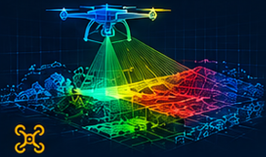
Deploying RTK-enabled drone photogrammetry and terrestrial 3D laser scanners, GK Infratech captures millimeter-precise site topographical data across complex terrains. We transform raw point clouds into georeferenced Digital Elevation Models (DEM), contour maps, and volumetric cut/fill computations.
Key Features & Workflows
🛸
High-Altitude Autonomous RTK Drone Surveys🎯
Terrestrial LiDAR 3D Laser Scanning⛰
Topographical Contouring & Elevation Modeling🚜
Cut-and-Fill Earthwork Volumetric Calculations🗺
Geographic Information System (GIS) AnalysisLET'S BUILD SMARTER
Start Your Project
Discuss requirements with our senior project architects and systems engineers.
Engineering Capabilities & Methodologies
- ✓Millimeter-accurate georeferenced spatial point clouds
- ✓CAD contour drawings with 0.25m interval precision
- ✓Earthmoving volumetric cut and fill audit reports
- ✓Boundary demarcation and land revenue record alignment
Performance98%
Cost40%
Sustainability84%
Tangible Deliverables Handed Over
☁️
Dense LAS/E57 point cloud scan files
🗺
2D/3D DWG topographical survey CAD maps
📸
High-resolution orthomosaic aerial photo maps